


“Drones” (officially known as unmanned aircraft systems) have proven useful both for the military and the public. They can be relatively inexpensive gadgets with a variety of capabilities such as taking aerial photos and video, surveilling, and carrying objects. However, until now, the Department of Homeland Security (DHS) could not evaluate and demonstrate drones in a timely manner because of the lack of a common testing site and high costs.
The DHS Science and Technology Directorate (S&T) is preparing to integrate drones in DHS’ and other federal agencies’ missions by providing accessible demonstration sites for land- and maritime-based operations. In the first half of January, professionals from S&T and the United States Coast Guard conducted demonstrations and tests at two sites in Mississippi.
Land-Based Drone Evaluation and Training at Camp Shelby
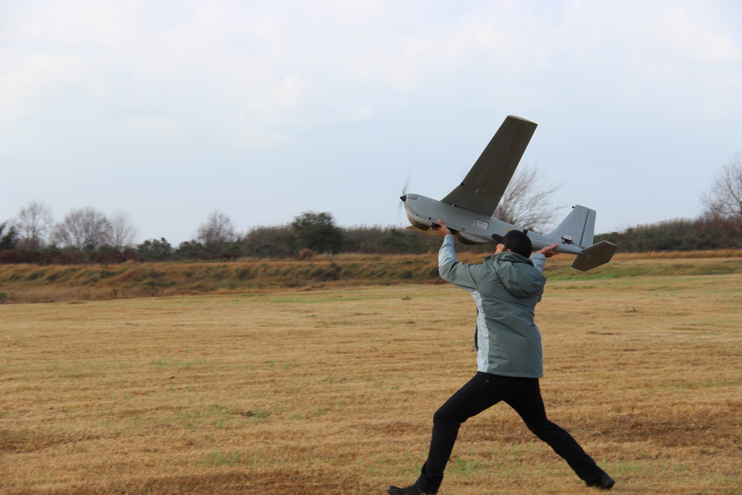
S&T held its first tour at Camp Shelby, Mississippi to show available outdoor space and building facilities for land-based testing and training with drones and robots. This site, available since August 2017 through a contract partnership with the Army National Guard, is intended for DHS components and other federal agencies, including U.S. Customs and Border Protection (CBP), the Coast Guard, U.S. Secret Service, Federal Emergency Management Agency, U.S. Immigration and Customs Enforcement (ICE), as well as the Federal Bureau of Investigation, and S&T’s First Responders Group. The cost to conduct tests is low for the agencies, covering only necessary test expenses.
”The Camp Shelby site has villages and rough terrain to use for different types of scenarios,” said Tim Bennett, S&T Program Manager for air-based technologies for land and maritime border security. “Any federal agency that is interested in demonstrating or evaluating, not only drones but also ground robotics, can go there.”
The site is an expansive plot of land spanning 35,000 square acres. It has restricted air space, managed by the Army National Guard who gives permissions for drones at the site.
In the future, S&T will demonstrate different drone capabilities and applications. For example, one of the capabilities will be equipping commercial drones with GPS that is resistant to jamming (blocking GPS signals) and spoofing (broadcasting false GPS coordinates).
“We can provide all our components, like ICE, Coast Guard, and CBP, a system they can use for protecting their drones from bad guys trying to either take over their aircraft, spoof or jam them,” said Bennett. “And at the same time locate the bad guys with the drones.”
Although “jammers and spoofers” are illegal in the United States because they could interfere with local airports’ GPS signal reception, some people still buy them for different purposes, such as to keep others from knowing where they have traveled.
Starting in June at Camp Shelby, S&T plans to evaluate some of the available drones on the market against scenarios suitable for ICE and Border Patrol operations, which will be followed by a report on the performance of these devices.
“It is sort of like a Consumer Report,” explained Bennett.
Drones will be evaluated for helping people in remote locations, such as mountains and in disaster areas to determine capabilities to find injured or lost people and to provide help from far away. During the demonstration day at Camp Shelby, attendees saw a medical drone that can transport a medical package that includes hi-tech glasses.
“You put the glasses on, and the doctor at another place who has the similar glasses can see what you can see and could direct you until help arrives,” explained Bennett. “For example, if you are bleeding, the doctor would explain how to put a tourniquet on.”
Maritime-based Drone Evaluations and Training at Singing River Island
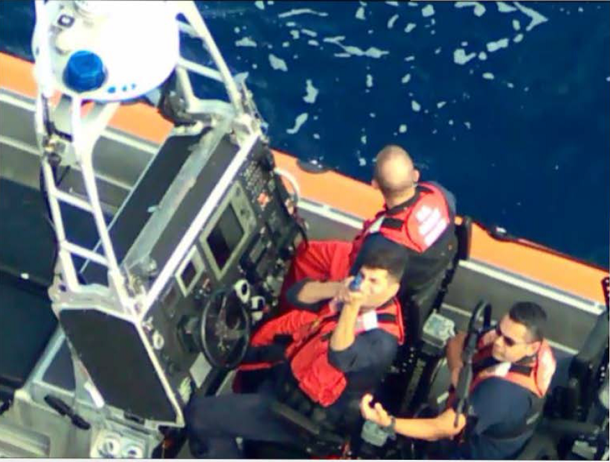
The same week on Singing River Island, in Pascagoula, Mississippi (only an hour and a half by car south from Camp Shelby) S&T and the Coast Guard held a VIP day for representatives from the Secret Service, Coast Guard, CBP, ICE, and the Federal Aviation Administration (FAA) for a maritime-based drone test. The payloads (additional technology a drone is equipped with) that were demonstrated included multispectral cameras that have the ability to map areas. This mapping technology is very useful for various DHS mission scenarios such as change detection, oil spills, search and rescue, and post-storm damage assessments. The Singing River Island facility is available for maritime evaluations of drones only to DHS through a contract partnership with Mississippi State University.
“We need to investigate what kind of payloads can be integrated on these drones, not just for Coast Guard’s mission scenarios, but for DHS as well,” said Stephen Dunn, research scientist who evaluates the Small Unmanned Aircraft Systems for the Coast Guard’s Research and Development Center.
“For maritime applications, it would be best if drones can land safely on water,” said Dunn. “We want to be able to throw them in the air, land them on the water, pick them up, change the battery, and throw them again.”

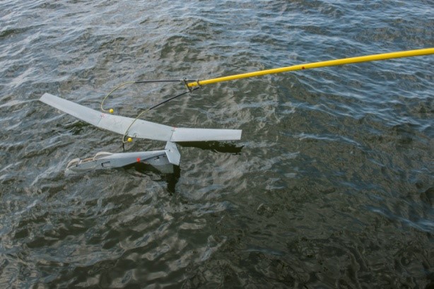
The Coast Guard and S&T worked with AeroVironment, one of the two companies manufacturing drones specifically designed for maritime operations. AeroVironment demonstrated their payload products and prototypes during the VIP day, which they flew against mission scenarios that S&T and the Coast Guard generated.
One important scenario is search and rescue. S&T and the Coast Guard evaluated the ability of AeroVironment drones, called Puma All Environment, to detect anchored rafts and simulated people in the water targets that are heated so that infrared cameras can detect them. The new i45 camera has the ability to autonomously provide a down-looking preset, called NADIR Mode, that was successfully used to map out a search area and detect targets.
“If an operator was doing this, he would be looking here or there, zooming in and out, and there is a chance he can miss a target,” said Dunn. ”With the autonomous camera, your coverage is 100 percent of the search area.”
Another mission scenario involved oil spills. The key for oil spills is that drones provide a better view from high above. “Drones can actually ‘see’ where the oil spill is going and how large it is,” said Dunn.
For post-storm damage assessment scenarios, traditionally, the Coast Guard would send an airplane or a helicopter, which have a high operating cost.
“Drones would cost significantly less,” said Dunn. “You can fly small drones and provide a rapid damage assessment.”
Border Patrol can also use this surveillance capability to track illegal immigration.
“Patrol officers can fly a drone over a period of time at the border to search for signs of illegal crossings – footprints in the sand or tire tracks,” said Dunn. “If migrants are coming across a certain path, the officers can see where they have actually crossed.”
Drones can be used to provide law enforcement agents situational awareness and surveillance. During law enforcement mission scenarios, drones flew over vessels where people carried fake weapons to evaluate if the camera could identify hand guns and rifles.
One of the key findings from the tests at Singing River Island is that payloads need to be assessed in more geographical locations. To see how sensors perform in different climates, the Coast Guard has been conducting tests, which will be completed this year, in five different locations – Alaska, California, Florida, Missouri, and the Gulf of Mexico.
DHS Drone Outlook
S&T is working with NASA and the FAA to eventually open up the national airspace to commercial drone traffic using a drone traffic management system known as Unmanned Aircraft Systems Traffic Management system.
“When the airspace is open for drones, around 2020, they are going to be everywhere,” Bennett said. “They have quite a few issues to solve beforehand and a lot of new technology needs to come out first.”
The Coast Guard is starting a one-year pilot program for short-range drone prototypes. And, currently, S&T is experimenting and demonstrating with drones.
“We are getting ready to launch the use of small drones as a standard DHS tool by taking advantage of the new test sites,” said Bennett.